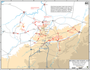
This is the map of the campaign as it opened on between 1st June 1815 and positions adopted by 07:00 on 16th June 1815. Napoleon was aiming to seize the Central Position between Wellington and Blucher. The Allies were spread out and had to work fast to concentrate their forces before Napoleon could isolate them and defeat them in detail. By moving from Charleroi as his point of concentration, Napoleon was perfectly poised to effect his strategy, whilst the strung out Allied forces risked a serious defeat or significant pushback. The crucial requirement for Marshal Ney to vigorously capture Quatre Bras and push on up the road is immediately apparent from this map. The opportunity for Ney to destroy the Prince of Orange’s force with an early assault before reinforcements could arrive is readily seen too.
Please note “Maps courtesy of the USMA, Department of History.” I’m very grateful for their kind permission to use them.
Get in touch